Thursday, December 4, 2014

Vertical Farms
This is pretty cool (and scary): how can we create indoor farms so we can grow enough food to feed all people?
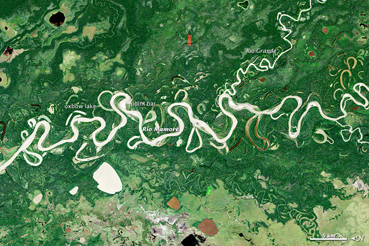
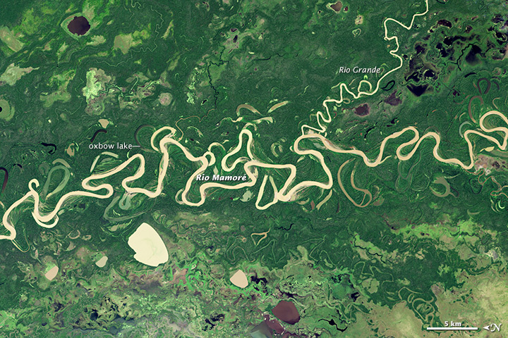
Meandering River
Here is a great image comparison by NASA showing how the course of the Rio Mamore has changed between 1985 (top) and 2014 (bottom). Be sure to look at the image comparison and full-resolution images online!


Wednesday, December 3, 2014
Digital Photography
There are some interesting things out there in terms of digital photography
- Time-Lapse Photography and the Canon Hack Development Kit.
- NIR photography using standard digital cameras using the instruction from Public Lab, Eigen Imaging, or instructables.com.
 |
| http://publiclab.org/wiki/near-infrared-camera |
Monday, December 1, 2014
Open Cities
Open Cities is a project aimed at creating an open data ecosystem for large cities / urban areas in South East Asia as part of the Open Data for Resilience Initiative (OpenDRI). (seen here on Geoawesomeness)


Subscribe to:
Posts (Atom)