
Showing posts with label Remote Sensing. Show all posts
Showing posts with label Remote Sensing. Show all posts
Wednesday, June 24, 2026

True Orthos vs Trad Orthos & ArcGIS Reality
First, what is ArcGIS Reality?

I'm not entirely sure, here's what Esri says: ArcGIS Reality is a suite of photogrammetry software products designed to enable reality capture workflows for sites, cities, and countries.
One main feature seems to be the abilaity to create & use so-capped True Orthophotos as opposed to Traditional Orthophotos.
- True Orthophotos vs. Traditional Orthophotos: Why do pixels matter in the age of AI?
- The Different Types of Ortho Images Created in ArcGIS
The animated GIF below demonsrates the main difference between true orthos & trad orthos.

Thursday, June 11, 2026
Ozone Pollution From Space
Air Pollution’s Daily Pulse Over the Northeast is a cool example of how we can now monitor air pollutions from space & how it changes over the course of the day! You start with the NO2 plumes from car exhaust & how they dissipate over the course of the day. Then you can look at the plumes of ground-level ozone created from the NO2 & their spatial patterns which are impacted by wind patters.
Saturday, May 30, 2026
Recent Land Use Changes: USA
This is interesting: A Shift in What’s Shaping U.S. Landscapes

The three main types of land use changes are urban sprawl, logging, and agriculture & here the New England has remained pretty stable over the last 40+ years or so. Why? The main land use changes had already occurred by 1988.
Friday, May 1, 2026
Your Name in Landsat!
Silly, but fun: Your Name in Landsat
Maybe even a good way to explore landforms in a Physical Geography class!
Thursday, February 5, 2026

Tuesday, November 18, 2025
Landsat Surface Temperature
This seems cool, but I have no idea what to do with it: Landsat Surface Temperature Web Mapping Application and Data. Joe Kerski has some ideas here.
Tuesday, November 4, 2025
3D model of Sutro Tower in San Francisco
This is super-slick: https://vincentwoo.com/3d/sutro_tower/
Sunday, October 5, 2025
Google Alpha Earth
Google Alpha Earth is a new geospatial AI model that acts as a virtual satellite: it assimilates all kinds of geospatial data & does the processing for you. Then, you just ask & get ready-to-use AI-generated 'maps' of whatever you want. No more working with dozens of raw datasets!
Example: glacier mapping. In thed old days you would have spent considerable time finding useful cloud-free images, do some kind of processing, and then run some kind of index or band-ratio calculations. Now you can just ask: give me the size of the Humboldt Glacier over the last 10 years.
For now the focus seems to be on physical data collected by sensors, but I would assume that human data from will be included in the future.
More here: AlphaEarth Foundations helps map our planet in unprecedented detail
The End of GIS: AI!
The AI Revolution is Coming for GIS: What You Need to Know About Microsoft’s Latest Warning is a pretty dire read...but you probably should add 5-10 years to this timeline. Here are a few take-home messages for me:
- The impact will be most-significant on the entry-level jobs.
- But, field work and basic project management will still be around for a while.
- Coding is still a key skill, but it will be all about AI-assisted coding in the very near future. But, you will need to have a good understanding of coding and how AI 'thinks' in-order to effectively prompt the AI.
- Take an online class in maschine learning for geospatial applications.
- Combine GIS expertise with complementary skills such as urban planning, environmental science, and more.
Tuesday, September 30, 2025
Historical Aerial Photos
Remember when air photos were a thing? Well, they still are! This place https://e-topo.com/mapv2.aspx offers the low-res 300 dpi versions for free somehow.
Friday, September 5, 2025
Pickleball vs. Tennis
Pickleball wins...it's not even close: How Pickleball Took Over Thousands of Tennis Courts, as Seen From the Sky

Wednesday, August 13, 2025
Monday, May 19, 2025

Thursday, February 20, 2025
The Milky Way Map
This is apparently the largest map of the Milky Way: https://archive.eso.org/scienceportal/home. Very cool, but I'm not sure what anyone can do with this...here's a little more beta from Joe Kerski.
Thursday, February 13, 2025
NAIP 2023 Imagery
I always forget about the NAIP Imagery - a great source for free satellite data at pretty decent resolution (30 cm / 60 cm).
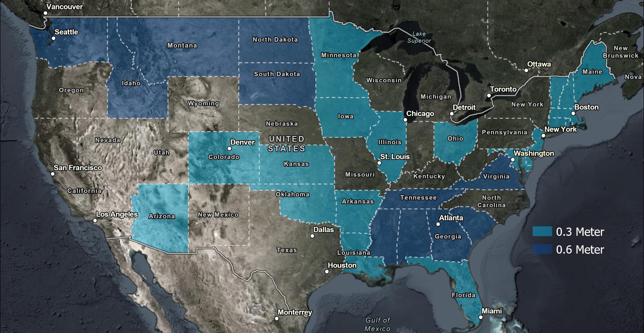
More here:
Thursday, January 23, 2025
SAR 'Images' in ArcGIS Pro
Good stuff here in-case you need to process SAR imagery in ArcGIS Pro: Getting to Know the SAR Analysis Toolset.
Thursday, December 5, 2024
Camp Century Found (again!)
Cool story here about Camp Century & how it was 'found' again by-accident during GPR airborne survey: New View of the “City Under the Ice”
Friday, October 25, 2024
Landsat Explorer & Sentinel-1 Explorer.
Landsat Explorer has been aroud & Esri just released a nice tutorial for it: Learn to explore Landsat imagery using Landsat Explorer.
Also available: The Sentinel-1 Explorer.
Thursday, October 10, 2024
Subscribe to:
Posts (Atom)