Saturday, February 25, 2017
Let's Drone a Map
Step by step guide to complete your first drone mapping project is exactly what it says - give it a try!
Friday, February 24, 2017

Web Literacy for Students (and Everybody)
Web Literacy for Student Fact-Checkers is a great OER 'textbook' on - well - how to be a responsible consumer of web information.
Saturday, February 18, 2017
Climate Change Board Games
Okay, I admit: I'm a little skeptical when it comes to the use of games or role-playing in science education. Still, Game changers (Science, 10 February 2017) reviews two new board games that could be useful:
Global Land Ice Measurements from Space
The book Global Land Ice Measurements from Space is now available for free download - nice!
Friday, February 17, 2017
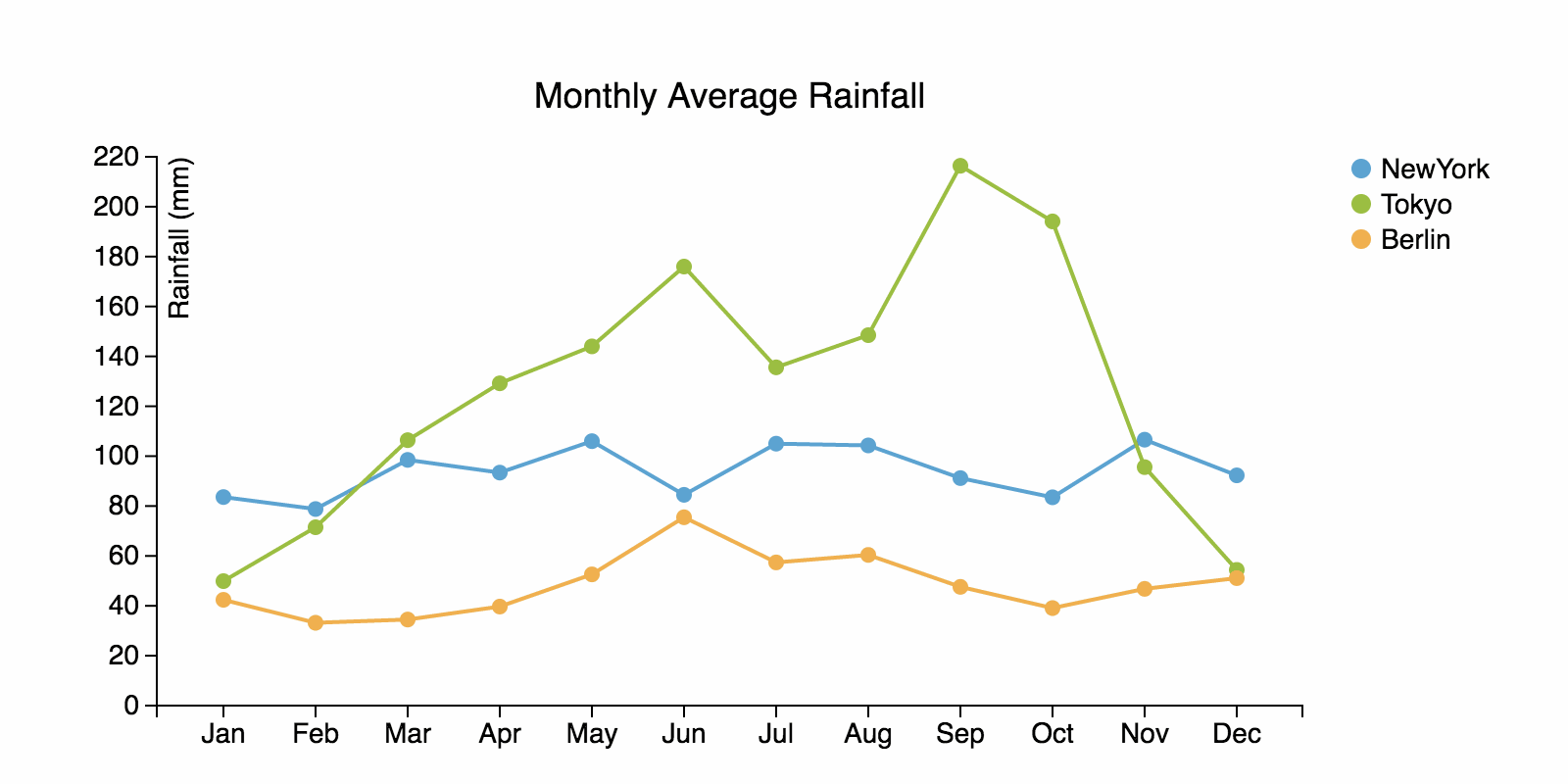
ChartAccent
ChartAccent is very cool: simply upload your data as a CSV file, chart it, annotate it, and export it - even as an animated GIF. Here's an example:
Thursday, February 16, 2017
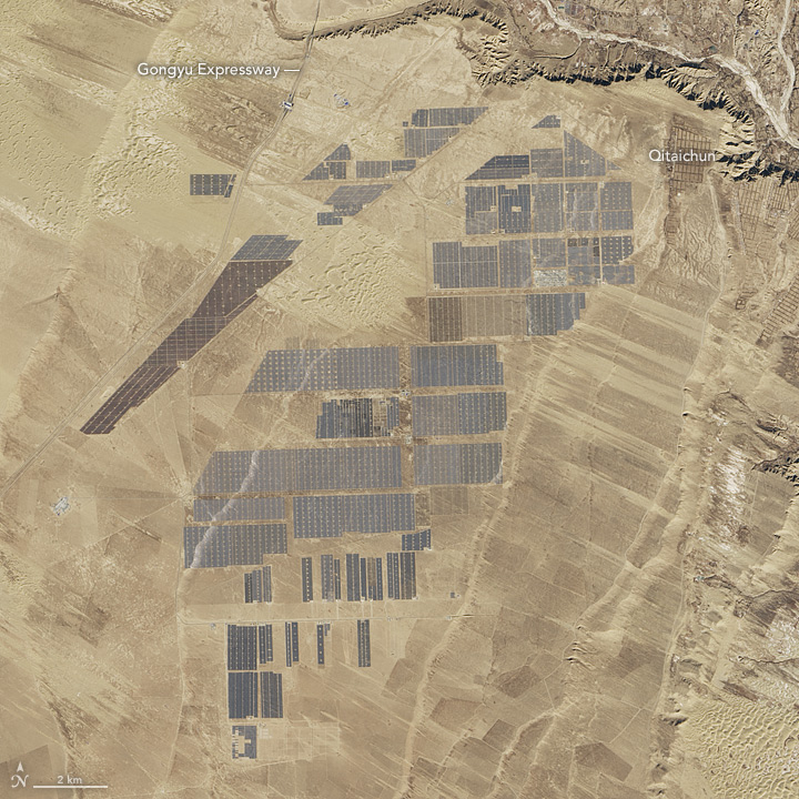
The World's Largest Solar Plant
Here is a nice image comparison by NASA showing the expansion of the Longyangxia Dam Solar Park in China using a Landsat 8 image from 2013 and 2017.

Saturday, February 11, 2017
Friday, February 10, 2017
Thursday, February 9, 2017
Cmap Tools
Cmap Tools have been around for a while now - they provide a nice concept map-based itinerary to get started with concept mapping. Also availble for iPad and cloud-based.
Wednesday, February 8, 2017
Intermediate Python
Here's a review of ArcGIS Blueprints - seems like a great choice for ArcGIS users as the next step beyond learning the basics of Pyhton.
Tuesday, February 7, 2017
Information Visualization
Enrico Bertini's course materials for his Information Visualization class are all available online. Thanks!
Sunday, February 5, 2017
Census Reporter
Census Reporter provides easy, fast tools to search for Census data about a place along with advanced tools for mapping, charting and comparing data at the state, county, and city levels.
Data Journalism: finding the stories inside the census. from NPR Training on Vimeo.
Saturday, February 4, 2017
A Short History of Humans and Germs
A Short History of Humans and Germs (by Skunk Bear) is great (here's the video) - looking forward to the continuation.

- Episode 2
- Episode 3

Science and Coding
The article by Monya Baker Scientific computing: Code alert (Nature, 26 January 2017) is not all that interesting, but has a few interesting links:
- Initial steps toward reproducible research (by Karl Broman).
- Data organization organizing data in spreadsheets (by Karl Broman).
- Data Carpentry for Biologists
Subscribe to:
Posts (Atom)