Saturday, March 7, 2020

Tuesday, March 3, 2020
Scribbling
Here are two fun and simple tools that allow you 'scribble' (= annotate) maps (seen on Maps Mania):
Fun and maybe useful in the context of the Digital Humanities.
Wednesday, February 26, 2020
Precipitation Measurements from Space
There is so much awesomeness here! First you see how the viewing area of the orbiting satellites widens as they approach the poles (as the lines of longitude converge). Then you can easterly trade winds in the equatorial regions and the westerlies with their superimposed mid-latitude cyclones.
Thursday, February 20, 2020
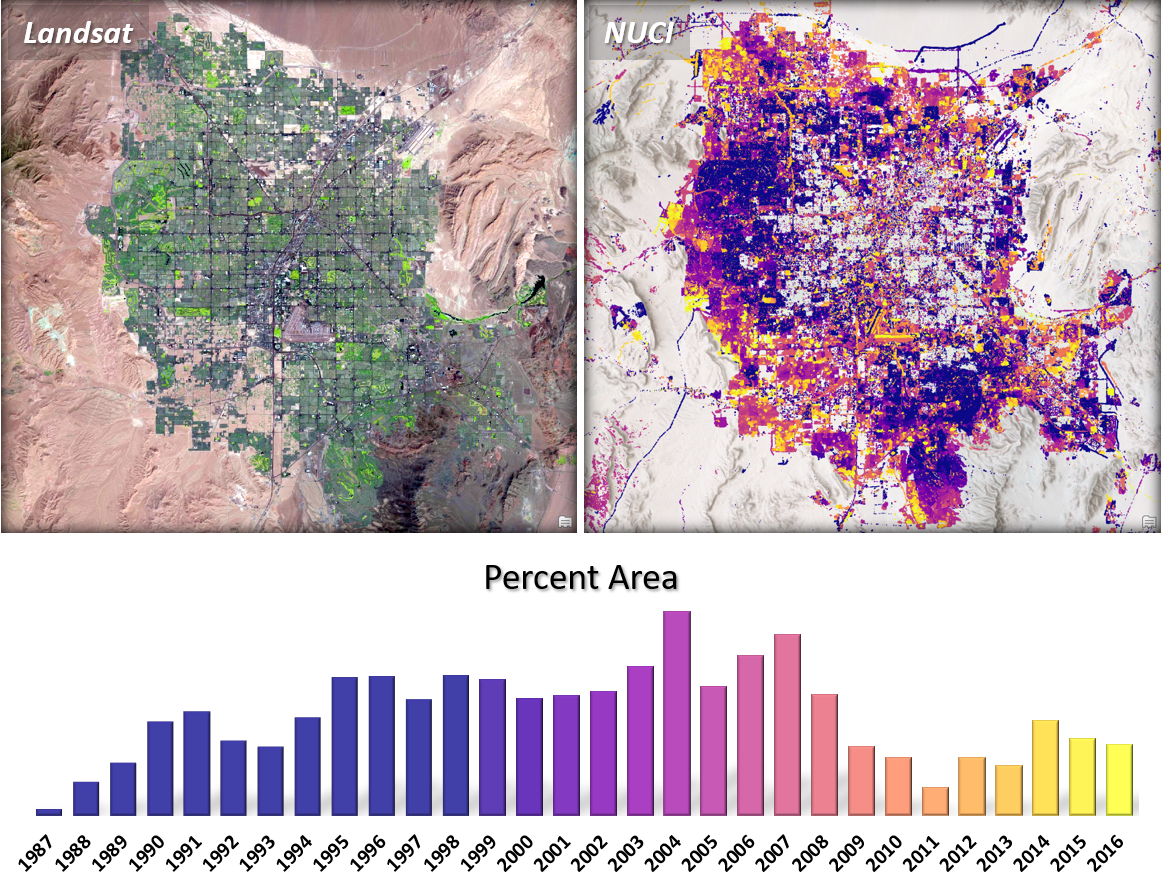
National Urban Change Indicator (NUCI)
The National Urban Change Indicator (NUCI) is available between 1987 and 2016 and somehow measures land use changes overtime, especially due to urbanization and other human-caused changes such as deforestation. Load into your ArcGIS map as a feature layer and use the Summarize Within GP tool to quantify changes with a specific area over time.
Wednesday, February 19, 2020
Tuesday, February 18, 2020
Plane Talking
This is super-cool: Plane Talking - here you can virtually 'fly' a commercial airliner from London to Manchester.
Subscribe to:
Posts (Atom)