Thursday, June 1, 2017
A 1.4-Billion-Pixel Map of the Gulf of Mexico Seafloor
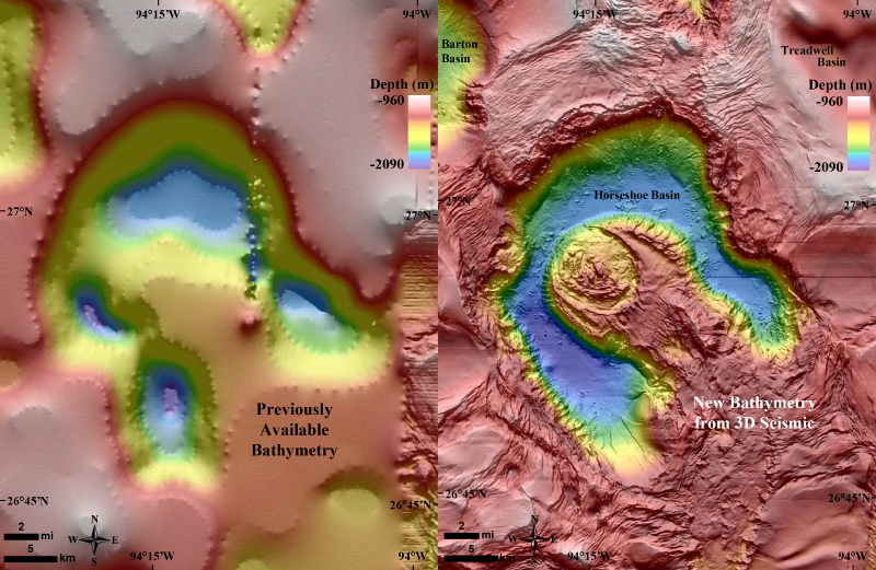
Who knew that we have a federal agency called the U.S. Bureau of Ocean Energy Management? I'm not quite sure what they do, but they just released a stunning bathymetry grid for the Gulf of Mexico. Read more about in EOS: A 1.4-Billion-Pixel Map of the Gulf of Mexico Seafloor.
Subscribe to:
Post Comments (Atom)
No comments:
Post a Comment