Tuesday, November 28, 2023

OS-Climate

OS-Climate is something, not really sure...but here is their vision statement:

OS-C is establishing an Open Source collaboration community to build a data and software platform that will dramatically boost global capital flows into climate change mitigation and resilience.

Through a non-profit, non-competitive organization, OS-C will aggregate the best available data, modeling, and computing and data science worldwide into an AI-enhanced physical-economic model that functions like an operating system, enabling powerful applications for climate-integrated investing in a world where the future will be very different from the past.

The OS-C technology platform will accelerate development of scenario-based predictive analytic tools and investment products that manage climate-related risk and finance climate solutions across every geography, sector, and asset class. The OS-C Open Source organization will enable alignment of the stakeholder community on priority data and modeling needs, focus shared resources on executing those priorities, and accelerate adoption.

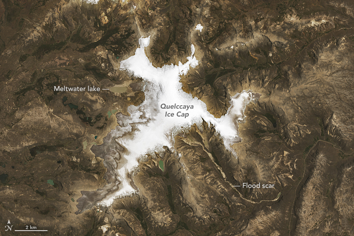
Quelccaya Ice Cap Then and Now

Quelccaya Ice Cap Then and Now shows a pretty stark comparison between the Quelccaya Ice Cap in 1988 and in 2023.


The Protein Problem

The Protein Problem is a pretty cool interactive website / scrolly map. The embedded quiz How do your protein habits compare? could be useful for teaching & learning.

Monday, November 20, 2023

4.5 Billion Years in 1 Hour


Alternatives to Google Street View

Maps Mania has compiled a nice list of open-source alternatives to Google Street View, for example Panoramax, Mappillary, and KartaView. These apps can be useful to share your own street-level photos, for example for your own project.

Thursday, November 16, 2023

RAWGraphs & Observable

Two interesting data viz options:
  1. RAWGraphs is free and open-source = great!
  2. Observable has a free pricing tier & looks similar to Datawrapper.
My personal take: stick with Google Sheets or MS Excel or choose a free and open-source product for your data viz.

Multilingual Surveys

Multilingual surveys are critical - otherwise you are excluding entire groups of people from your dara collection. Seems like ArcGIS Survey 123 allows you to author multilingual surveys right in the web designer - that seems like something that Google Forms should be able to add?

More here: Author Multilingual Surveys in the Survey123 Web Designer

Monday, November 13, 2023

Felt

Felt proclaims it self to be "A better way to work with maps. Powerful enough for GIS Pros, easy enough for everyone else". Well, maybe.
  • Felt seems like an online web mapping platform to accompany QGIS?
  • Seems like they want to position themselves between the Nat Geo Map Maker (= no analysis) and ArcGIS Online.
  • Not sure if I would be willing to put my work on a start-up like Felt that may disappear in a few years.

Wednesday, November 8, 2023

Pathfinding

Cool, but not sure how useful: https://honzaap.github.io/Pathfinding/. Define the start and end points and then see the shortest path emerging.

Living Like The Dutch

This is cool: add an address and the AI will 'change' it to what it could look like when you replace cars with bikes, create pedestrian-only streets, and more: https://dutchcyclinglifestyle.com/.

Monday, November 6, 2023

Transit Map Projections

This is kind of cool: you can display public transportation maps in different projections, for examples a geographical projection vs. an octilinear projection that is typically used on the public transit maps.
Here's Boston