Landsat8.earth is basically a Landsat 8 viewer that can do 'normal' (2D), but also 3D - pretty cool.
Wednesday, September 30, 2020
Monday, September 28, 2020
Saturday, September 26, 2020
Everybody Is Dead!
Cool data viz from the Washington Post: What if all covid‑19 deaths in the United States had happened in your neighborhood? The result is basically a circle around your location in which everybody is dead assuming 202,329 deaths - a sobering way to help us 'see' what 202,239 deaths actually would look like.
Friday, September 25, 2020
Data Viz Tools
Here are some useful resources.
MySQL.
- SQL Tutorial / SQL Zoo
- Using MAMP and Sequel Pro (8:26 minutes)
Thursday, September 24, 2020
Rewiring America
Rewiring America is a good study and a good read: yet another reasonable approach to solve climate change via clean energy. I especially like the call for a shift in mindset from 1970s thinking (efficiency, scarcity, sacrifices) to 2020 thinking (abundance, prosperity). This may be what is really standing in our way (and the special interests of the fossil fuel world).
Tuesday, September 22, 2020
Five maps you (and your team) should see
These compilations are always tricky, but these are solid choices: Five maps you (and your team) should see.
Saturday, September 19, 2020
Tesla Supercharger Network
The Tesla Supercharger Network is a nice interactive map rendered in Tableau Public. Yep, Tableau Public can do interactive maps and spatial analysis and this may be a good option in certain situations. For all else: use a proper Web GIS!
Friday, September 18, 2020
MS Excel / Google Sheets Tutorial Videos
There are 1,000s of such videos, but I like Vertex42 a lot.
- They are short and complete.
- They often use the same data set for both MS Excel and Google Sheets so it's easy to compare how these two different tools work.
- The data sets are available for download or just require some quick tying and you can follow along step-by-step.
Thursday, September 17, 2020
Earth Now!
This is pretty cool: Earth Now (by NASA). Shows the most-current satellite images and the path of the earth-orbiting satellites, all in 3D.
Wednesday, September 16, 2020
Data Journalism and Visualization with Free Tools
Free self-directed MOOC: Data Journalism and Visualization with Free Tools
Tuesday, September 15, 2020
How America can leave fossil fuels behind, in one chart
Well - here's yet a third plan to get us away from fossil fuels (in addition to The Solutions Project and the recent UC Berkeley Study):
- Rewiring America (book)
- The Chart (Energy Literacy)
Saturday, September 12, 2020
The Math of Masks
This is great: https://aatishb.com/maskmath/. Watch the video, then play around with the simulations.
90 Percent By 2035
The Solutions Project is a plan to get to 100 percent carbon-free energy by 2050 and now we have a new study out of UC Berkeley with a pathway to 90 percent carbon-free by 2035. Cool, let's do it!
Friday, September 11, 2020
THE TERRAINATOR
THE TERRAINATOR gives you 3D-printable terrain models. Well, you can have them 3D printed for a price or buy the STL file for yourself.
Historic Streetview
Streetview is great, but what about the past? Here are two options:
- Chronobook is great - make sure that you zoom-in enough as photographs and entire collections may pop-up.
- Historypin is a similar approach.
Thursday, September 10, 2020
Thunderstorms over Lake Victoria
Nice example of convection within the Trade Winds: Watching Thunderstorms March Across Lake Victoria.
Saturday, September 5, 2020
Wakelet
So Wakelet is pretty hip: basically an easy and fun way to curate things that you find on the Internet. Nothing that you could not do with a blog or a Google Doc, but with a fun and intuitive interface. Here are a couple of good resources:
- Wakelet (UMass Educ Class review)
- Using Wakelet In The Classroom For Curation And Research
The Four Laws of Learning
All the usual caveats apply, but the 4 Laws of Learning (and How to Follow Them) is very helpful, for example for new college/university faculty who may have never had any training in pedagogy.
Friday, September 4, 2020
Turnitin = Evil
That's the synopsis - more details here: A Guide for Resisting Edtech: the Case against Turnitin
Would you upload your paper to a commercial website with these terms of service:
"Any communications or material of any kind that you e-mail, post, or transmit through the Site (excluding personally identifiable information of students and any papers submitted to the Site), including, questions, comments, suggestions, and other data and information (your “Communications”) will be treated as non-confidential and nonproprietary. You grant Turnitin a non-exclusive, royalty-free, perpetual, world-wide, irrevocable license to reproduce, transmit, display, disclose, and otherwise use your Communications on the Site or elsewhere for our business purposes. We are free to use any ideas, concepts, techniques, know-how in your Communications for any purpose, including, but not limited to, the development and use of products and services based on the Communications."
Thursday, September 3, 2020
NASA EO Explorer
Very cool: NASA's new EO Explorer has a simple and intuitive interface - just pick a spot and zoom in to find great images. Noting fancy, but it works.
Tuesday, September 1, 2020
COVID Pulses
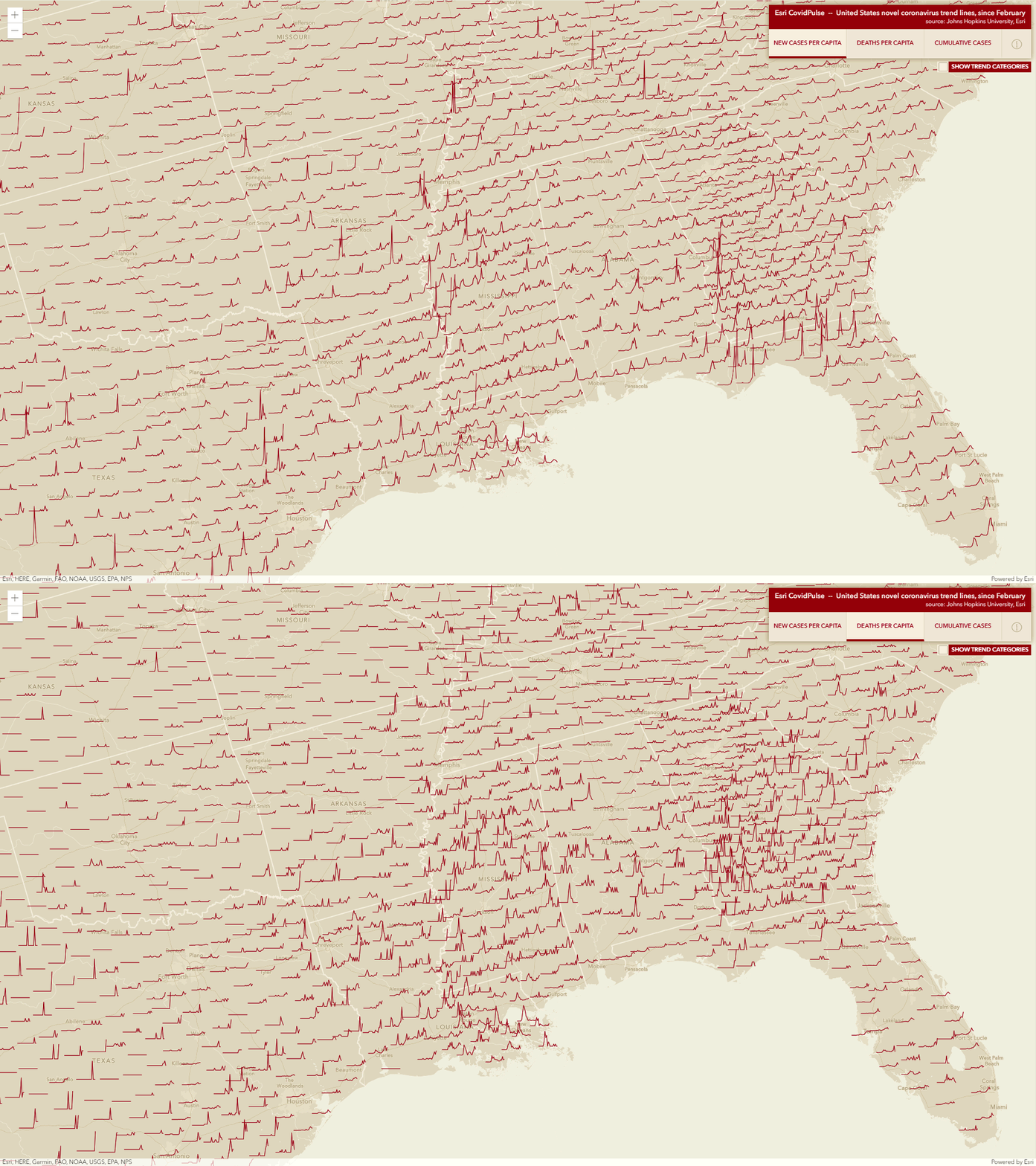
Great idea: let's make sparklines for each county in an interactive web map. Read more about it here and see it here: Esri COVIDPulse. Or: watch the CovidPulse Video and take a narrated tour!
The Mirror Cam
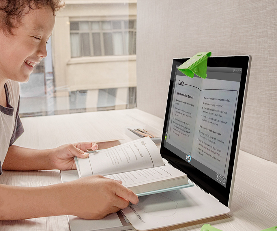
This is cool: a simple 'mirror cam' to act as a doc cam: IPEVO Mirror-Cam. Read more about it here. $40 for 6 of them, so the idea is to buy them / mail them to all your students.


