Wednesday, February 27, 2019
The Lifespan of News Stories
The Lifespan of News Stories is pretty cool with an animated timeline of 2018 and a matching interactive map below. I wonder if one could 'classify' the shapes of these 'curves' and create a model to predict the level, intensity, and duration (= lifespan) of future news stories.
Monday, February 25, 2019
Saturday, February 23, 2019
Earth's Topography
Earth Elevation is a nice data-viz, slicing the Earth's topography and bathymetry along lines of latitude.
Wednesday, February 20, 2019
What We Could Do.
Great data viz from the NYT - what we could do in terms of emission reductions if we would adopt policies in-place around the world: How to Cut U.S. Emissions Faster? Do What These Countries Are Doing.
Tuesday, February 19, 2019
Monday, February 18, 2019
Cyber GIScience Literacy
Yep, that's a term - read more about it here: Cyber Literacy for GIScience: Toward Formalizing Geospatial Computing Education (Shook et al., 2019).
Interesting read, but it is difficult not to get a little disillusioned when you are actually teaching Introduction to GIS to undergraduates in 2019. I like the inspirational ideas, but let's start with some basic computer literacy (where's my file and why does it matter?) - that's especially a problem for Mac users.
Interesting read, but it is difficult not to get a little disillusioned when you are actually teaching Introduction to GIS to undergraduates in 2019. I like the inspirational ideas, but let's start with some basic computer literacy (where's my file and why does it matter?) - that's especially a problem for Mac users.
 |
| https://blogs.agu.org/onthejob/files/2019/02/Forrest-blog.jpg |
Saturday, February 16, 2019
Katharine Hayhoe @ TEDWoman 2018
Katharine Hayhoe is getting a little overexposed these days, but her message is important in this TED Talk. Even better is her Global Weirding with Katharine Hayhoe YouTube channel.
3D Printing
Noting new to see here, but some useful links related to 3D printing:
- https://www.myminifactory.com/
- https://www.thingiverse.com/
- OpenSCAD (3D modelling software)
Thursday, February 14, 2019
Shifting Cities Due To Climate Change
Simple and powerful!
- What will summers be like in 2100 for 1001 cities in the USA?
- What will winters be like in 2100 for 1001 cities in the USA?
- What will summers be like in 2100 for cities around the world?
- What will climate feel like in 60 years? (paper)
Wednesday, February 13, 2019
Tuesday, February 12, 2019
Sunday, February 10, 2019
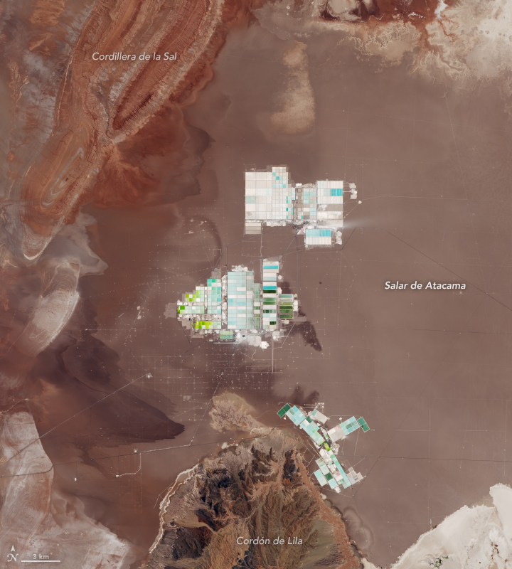
Where Batteries Begin
Where Batteries Begin has great pictures and information on how and where we get the lithium we need for all these batteries that will solve global warming.
Climate Change in 10 Words
After John Cook: It’s real. It’s us. It’s bad. Experts agree. There’s hope.
Thursday, February 7, 2019
Sunday, February 3, 2019
Urban Footprint
Urban Footprint sounds cool, but even after exploring their website I'm not sure what it really is...they claim that Urban Footprint will allows us to "Teach basic and advanced planning methods without the hassle of traditional GIS systems".
Subscribe to:
Comments (Atom)


