- SuperGIS Desktop 3. This seems to be a desktop-based application along the lines of the (open-source) MapWindow.
- Map2Net (a cloud-based GIS application) - starts at 2,000 Euros per year...
Monday, July 29, 2013
More GIS software
Here are a couple of GIS software packages I recently saw - probably not all that useful as there are better and cheaper (i.e. free) commercial and open-source alternatives.
Saturday, July 27, 2013
Social Media in K-12
Or in Higher Education...here's an interesting infographic about it. I'll be honest: I have no idea who the source is...the website www.bestmastersineducation.com/ does not indicate anything (which is usually a red flag).
Shape Escape
Shape Escape is a useful little website/app to convert shapefiles to Google Fusion Tables (i.e. KML) or to geoJSON and topoJSON. Of course, ArcGIS can do all that...this 'frees' you from Esri if needed.
www.marinetraffic.com
This may sound boring...but this is a great example of a real-time, global, and interactive web map - in this case showing the location, speed, and direction of all marine traffic (boats, ferries, tankers, etc.). Click on the icon to see information about the vessel and a picture. A great place to explore is the English Channel or the area around busy ports such as Hong Kong.
- www.marinetraffic.com/ais
- More interested in air traffic? Try Plane Finder!
Friday, July 26, 2013
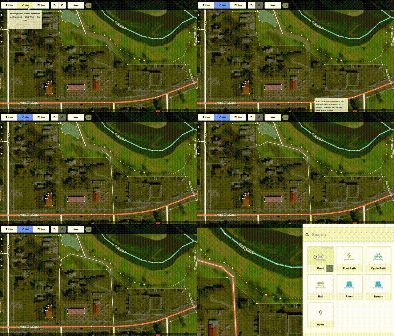
OpenStreetMap Map Editor
This has been missing from OSM: a quick and easy way to contribute and make edits. Well, no more! Now there is a simple to use map editor for everyone - nice!
Thursday, July 25, 2013
DigitalPlanet.org
DigitalPlanet.org is a website dedicated to using Google Earth in Geoscience education - cool! There is also a matching book Google Earth and Virtual Visualizations in Geoscience Education and Research published by the Geological Society of America.
Sigh...yet another source of good and useful course materials...not that that is bad, but how do we possibly keep track of all that is available? At the end this 'excess of non-organized resources' forces you back to your starting point: create your own materials! (which, in the end, is probably the best approach anyways...) There is really no difference between these crowd-sourced activities and the standard, one-size-fits-all approach of traditional textbooks and lab manuals.
Sigh...yet another source of good and useful course materials...not that that is bad, but how do we possibly keep track of all that is available? At the end this 'excess of non-organized resources' forces you back to your starting point: create your own materials! (which, in the end, is probably the best approach anyways...) There is really no difference between these crowd-sourced activities and the standard, one-size-fits-all approach of traditional textbooks and lab manuals.
GEOLocate
This is interesting - an application that (somehow) is able to georeference qualitative location information = somehow convert location names, distances, compass bearings, etc. into proper geographic coordinates. Not sure how well it works, but worth checking-out: they have a browser-based application as well as a stand-alone desktop application.
OpenGeoportal
OpenGeoportal is nothing particularly new - essentially an online clearinghouse for geospatial data. It can get a bit messy when digging around inside the map-based interface, but that's a small price to pay for getting access to all those data.
Field Papers
This is a fun and useful little application: make a map, format it to include space for notes and observations, create a PDF, print it, and take your field book into the field! This would be great for field trips, labs, and other activities where you take students outside.
Monday, July 22, 2013
Health Map of the United States
Here is a great interactive web map of three health indicators (life expectancy, obesity, and physical activity) mapped across the USA at the county level. Read the related article for more information.
The Clear Congress Project
This is very cool: a map/visualization of the U.S. Congress - reminds me a bit of Gapminder. Read the associated blog for additional information and data analysis.
Immersion - The Geography of Email
This is a fun way to make a 'map' of your Email history and connections.
See also: The Geography of Facebook and The Geography of Twitter
Saturday, July 20, 2013
Online Geologic Map of the U.S.
This is pretty cool (if you are into geology...) - the National Geologic Map Database (NGMDB), viewable as an interactive web map. But, you can also 'see' the map as more traditional searchable catalog.
Every Congressional District - Ever!
Every district - ever - in Esri shapefile format!
Public Transit Times
Seen on FlowingData: how long does it takes to get to B from A using only public transit and (maybe) walking? Here are examples of a network / service area analysis and as expected you can clearly see the 'speed' effect of major roads.
- NYC Transit Times (no walking)
- Seattle, San Francisco, Denver, and Boulder (with walking)
- Trulia.com commute time
Subscribe to:
Comments (Atom)


